Toll Free: 1800 419 3356

End-to-End Drone Solutions

Mining Solutions

Data speaks volumes about Your site

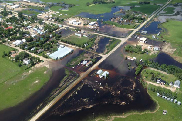
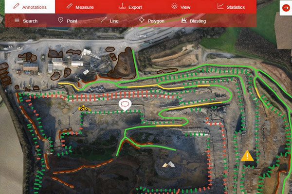
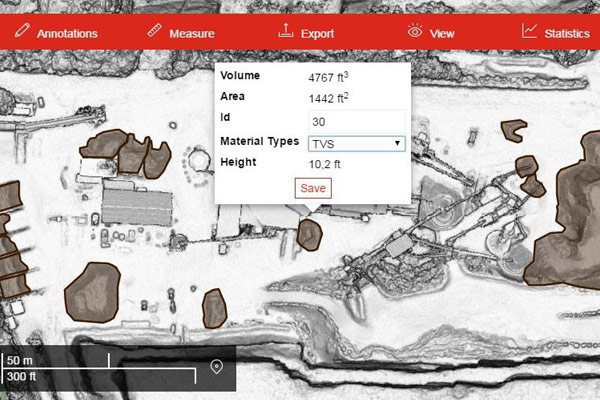
Get a complete and accurate view of each of your sites and greater visibility across all of your sites, anytime, anywhere.

We provide

  • Periodic volumetric measurement of stockpiles
  • Comprehensive analytical reports on stockpile location and inventory tables per site
  • Analytical reports on Haul roads monitoring for safety and compliance on site
  • Collaboration of data online on a cloud based platform for better understanding and visualization

Agricultural Solutions

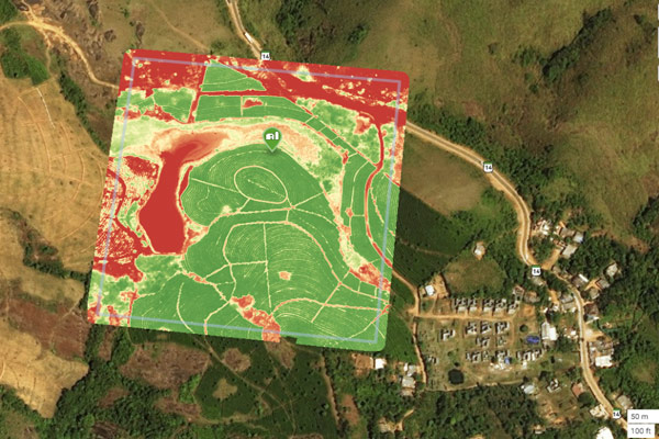
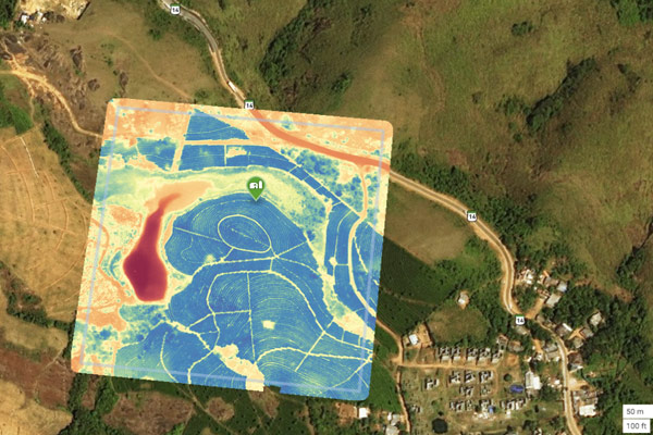
With a Drone or UAV you can capture highly accurate images of your fields, covering up to hundreds of hectares/acres in a single flight without the cost and hassle of manned services. At a far greater resolution than satellite imagery provides, even when there is cloud cover.

We provide

  • Higher resolution Orthophotos
  • 3D point cloud data gives information pertaining to plant height and crop uniformity.
  • High resolutions reflectance maps, DSM, Contours and Vegetation Index (NDVI/NDRE/OSAVI)

Urban Development & Planning

  • Land Audit And Survey – detecting encroachment & deviations
  • House Tax Assessment
  • Change Detection And Analysis
  • City Planing
  • Topographical Survey

Oil & Gas Solutions

UAV Technology in Oil & Gas Survey facilitates:

Safer and quicker inspections

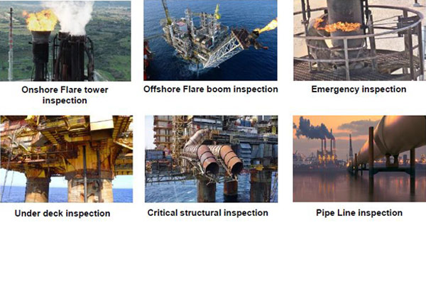
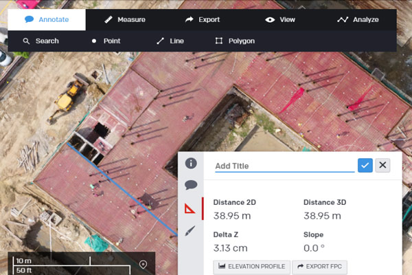
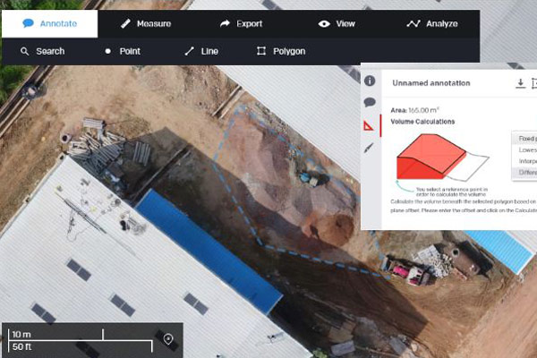
Perform faster inspections and improve worker. safety by minimizing use of scaffolding, cranes, or helicopters.

Better inspection information

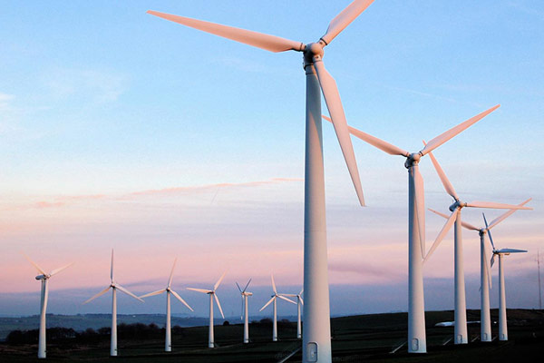
Spot issues earlier by using visible light and infrared sensors to inspect flare stacks and chimneys while operating.

Minimize facility downtime

Maintain production goals by avoiding shutting down equipment for routine facility inspections.

We provide

  • Critical Infrastructure Inspection (Thermal & Visual)
  • Pipeline Inspection (Thermal & Visual)
  • Aerial Survey For Pipeline Alignment & Re-Alignment

Road Survey & Inspection

We provide extensive analytical report on road survey and inspection

We provide

  • CCut & Fill Analysis
  • Pipeline Inspection (Thermal & Visual)
  • Volumetric Analysis
  • Design and Planning
  • Construction Progress Monitoring
  • Elevation Profile And Contours
  • Change Analysis
  • Topographical Survey

Construction Site Survey

Now keeping track of progress on construction sites is easier and more up-to-date.

We provide

  • Site Planning
  • Cut & Fill Analysis
  • Volumetric Analysis
  • Design and Planning
  • Construction Progress Monitoring
  • Elevation Profile And Contours
  • Change Analysis
  • Topographical Survey

Renewable Energy Plant Survey

  • Solar Power Plant Survey: Panel Placement, Shadow Analysis, Topographical Survey, Cut & Fill Analysis, Volumetric Analysis
  • Solar Power Plant Maintenance: Solar Panel Thermal Inspection
  • Wind Farms: Wind Mill And Blades inspections
  • Hydel Project: Dam Inspection, Submergence Area Survey, River Linking Area Survey
  • Thermal Power Plants: Chimney Inspection & Other Critical Area Inspection

Disaster Management

  • Flood Zone Risk Analysis
  • Landslide Prone Zone Identification
  • Rapid Areal Survey For Post Disaster Relief Wor

Industrial Inspection

  • Critical Infrastructure Inspection (Thermal / Visual)

Power Lines Solution

  • Power Transmission and Distribution Lines Inspection (Thermal / Visual)

Railway Track Monitoring

  • Station Areal Survey
  • Cut & Fill Analysis
  • Volumetric Analysis
  • Design and Planning
  • Construction Progress Monitoring • Elevation Profile and Contours • Change Analysis • Topographical Survey

Forestry Application

  • Forest Area Mapping
  • Wild Life Detection
  • Monitoring Mining Sites